Town of Hebron
NEW – PUBLIC WORKS BUILDING PROJECT SURVEY RESULTS
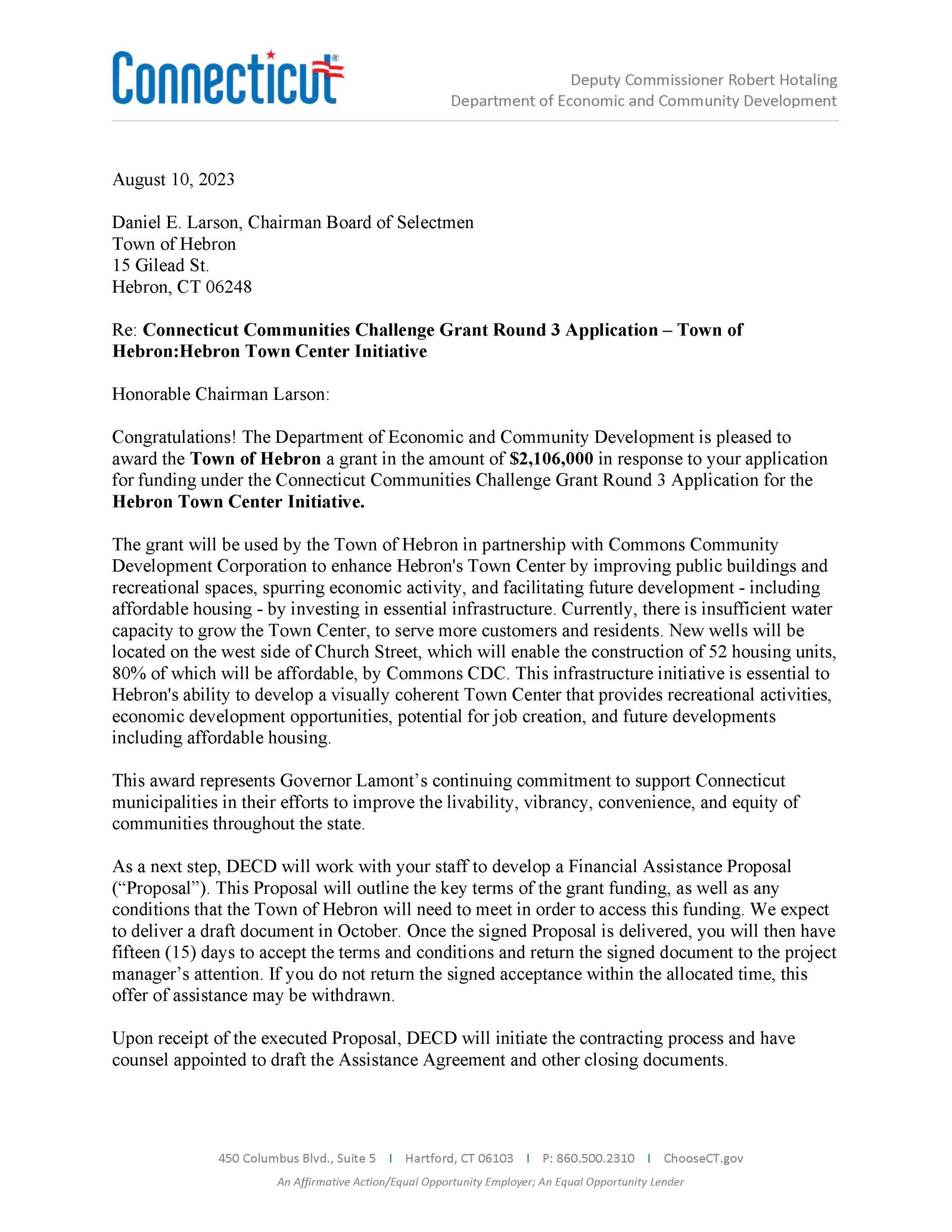
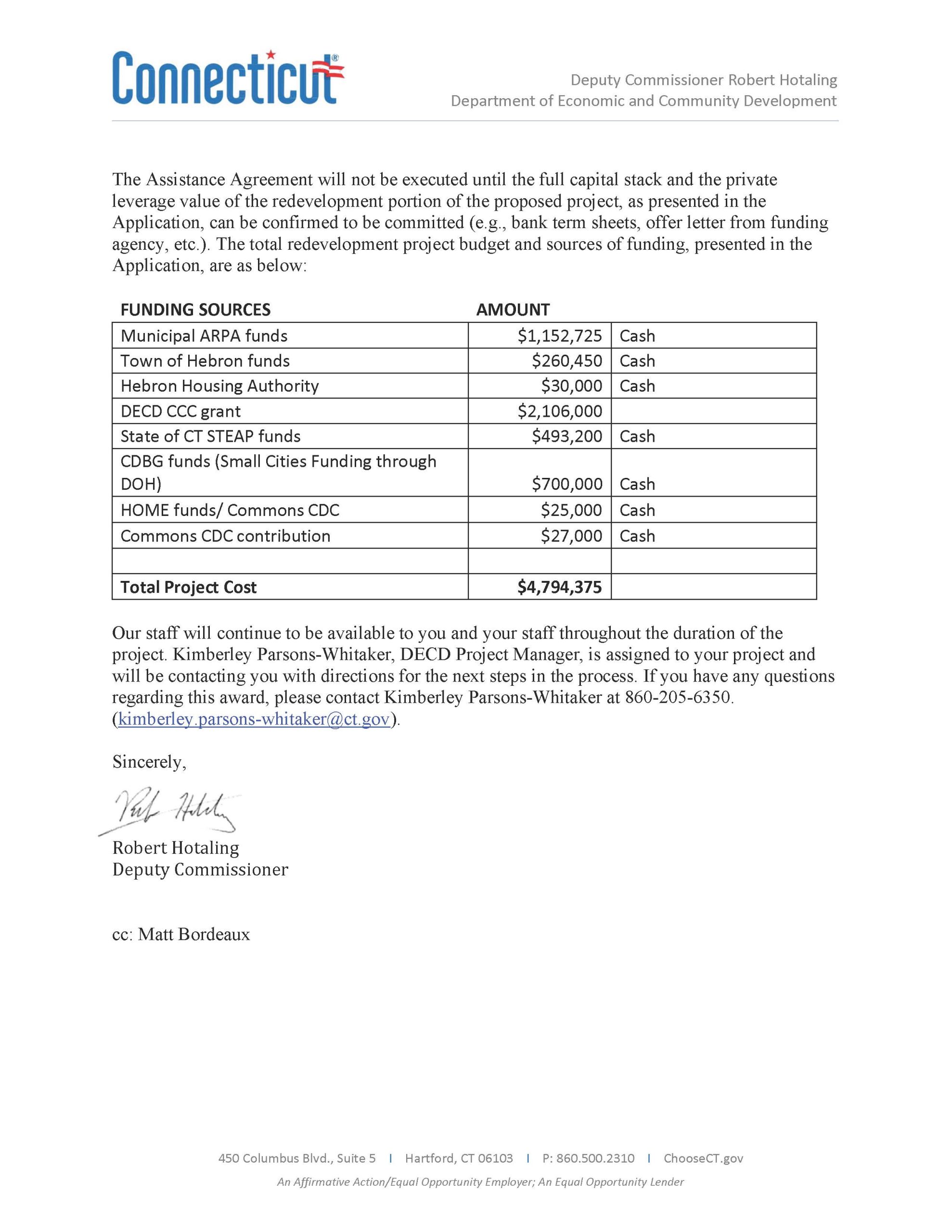
CT Communities Challenge Grant Award
TTCP August 4, 2023 Concert Postponed due to Weather
Postponed due to weather , Rain Date to be announced shortly. Mother Nature does not want to cooperate this year!! We are looking into have Carl Ivermore the Moonjoose back next Sat the 12th but waiting on the Confirmation. Thanks So Much
Hazard Mitigation and Climate Adaptation Plan (HMCAP) Update for the CRCOG Region
Veteran’s Ceremony Photographs – July 18, 2023
Public Works Building Project Survey has ended
Thank you for all those that took the time to complete the Hebron Town Survey regarding the Public Works Building Project.
The survey is now closed.
The information is being evaluated and an update will be provided in the very near future.
If you have any questions, please contact the Town Manager’s Office.
TTCP Summer Concert Scheduled for Friday, July 21, Cancelled Due to Weather
The Town Center Project Summer Concert “The Sounds of Frank” scheduled for Friday, July 21, 2023,
has been cancelled due to the weather forecast.
New Air Line Trail Website and Maps!
At long last, the 12-Town Air Line State Park Trail Master Plan is complete. A new website (alsptregion.org) is available to view the contents of the Plan and learn more about the wide variety of resources accessible from, or nearby, by the Trail. New Maps highlighting each of the twelve Towns were produced and will be distributed at select trailheads and other public places. Many local community members participated in the Master Planning process and their hard work is reflected in the materials produced. We hope you will take some time to visit the website, and more importantly, to get outside and spend some time on the Trail. See you there!
Concert Postponed Until August 4, 2023
The TTCP Summer Concert scheduled for tonight, July 14, 2023, has been postponed until August 4, 2023, due to the weather forecast.
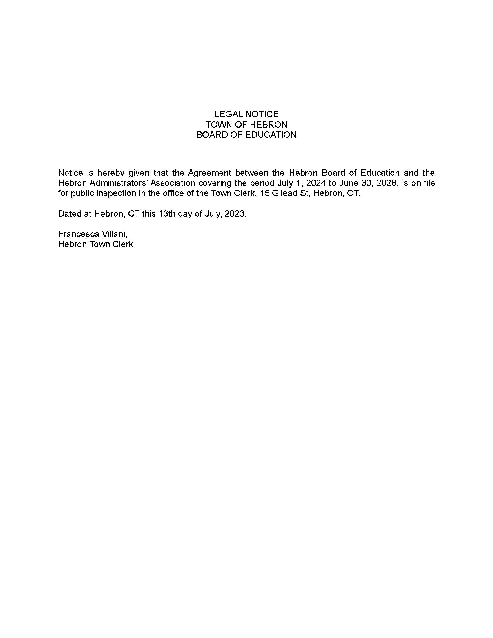
Legal Notice – Hebron BOE Administrator’s Contract